Geolocate

Gropparo topographic map

Click on the map to display elevation.

About this map

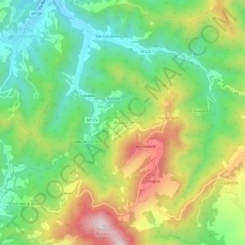
Name: Gropparo topographic map, elevation, terrain.

Location: Gropparo, Dernice, Alessandria, Piemonte, Italia (44.74628 8.99999 44.78628 9.03999)

Average elevation: 471 m

Minimum elevation: 273 m

Maximum elevation: 778 m

Gear up for your next adventure:

🥾Waterproof Hiking Boots - Essential footwear for rugged terrain and wet Canadian trails
🛌Insulated Sleeping Pad - Critical thermal barrier between you and the cold ground
🎒Backpack Rain Cover - External shield to keep your entire pack dry
🕯️Camping Lantern - Illuminates your entire campsite with high-efficiency LEDs
🧦Hiking Liner Socks - Thin base layer to prevent friction and blisters

As an Amazon Associate, this site earns from qualifying purchases at no extra cost to you.