Geolocate

Syracuse topographic map

Click on the map to display elevation.

About this map

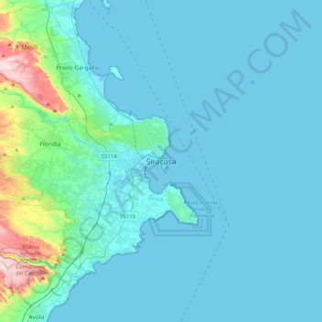
Name: Syracuse topographic map, elevation, terrain.

Location: Syracuse, Siracusa, Sicily, Italy (36.90461 15.13072 37.22461 15.45072)

Average elevation: 48 m

Minimum elevation: -1 m

Maximum elevation: 519 m

Gear up for your next adventure:

🧭GPS Tracker - Track your location in remote areas safely
🧼Biodegradable Camp Soap - Environmentally friendly cleaning for gear and body
🥾Durable Hiking Shoes - Long-lasting shoes for frequent hiking
🥾Approach Boots - Comfortable boots for hiking and climbing approaches
🛶Waterproof Dry Bags - Keep electronics and clothes dry during river crossings

As an Amazon Associate, this site earns from qualifying purchases at no extra cost to you.