Geolocate

Clamart topographic map

Click on the map to display elevation.

Clamart

La superficie de la commune est de 877 hectares ; l'altitude varie de 64 à 175 mètres.

About this map
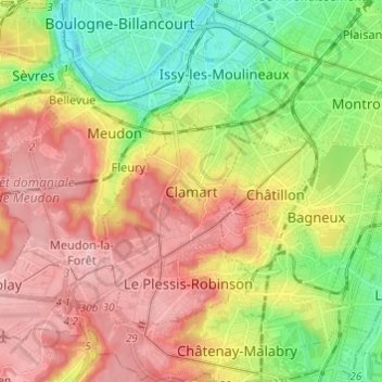
Name: Clamart topographic map, elevation, terrain.

Location: Clamart, Antony, Hauts-de-Seine, France métropolitaine, 92140, France (48.76037 2.22303 48.84037 2.30303)

Average elevation: 104 m

Minimum elevation: 23 m

Maximum elevation: 187 m

Gear up for your next adventure:

👟Sport Hiking Sandals - Breathable footwear for water crossings and camp rest
🧥Fleece Jacket - Warm and lightweight jacket for layering
❄️Traction Ice Cleats - Slip-on spikes for icy trails and winter hiking
🧢Sun Hat - Wide-brim hat for sun protection
🧼Travel Hand Sanitizer - Keep hands clean when water is scarce

As an Amazon Associate, this site earns from qualifying purchases at no extra cost to you.