
Thank you for supporting this site ❤️
Make a donation
Make a donation
Gear up for your next adventure:
As an Amazon Associate, this site earns from qualifying purchases at no extra cost to you.
Falougha topographic map
Click on the map to display elevation.
Thank you for supporting this site ❤️
Make a donation
Make a donation
Gear up for your next adventure:
As an Amazon Associate, this site earns from qualifying purchases at no extra cost to you.
About this map
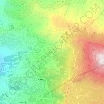
Name: Falougha topographic map, elevation, terrain.
Location: Falougha, Baabda District, Mount Lebanon Governorate, Lebanon (33.81728 35.72117 33.85728 35.76117)
Average elevation: 1,287 m
Minimum elevation: 829 m
Maximum elevation: 1,907 m
Thank you for supporting this site ❤️
Make a donation
Make a donation
Gear up for your next adventure:
As an Amazon Associate, this site earns from qualifying purchases at no extra cost to you.