Geolocate

Traverse Lake topographic map

Click on the map to display elevation.

About this map

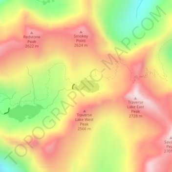
Name: Traverse Lake topographic map, elevation, terrain.

Location: Traverse Lake, Union County, Oregon, United States (45.11983 -117.44262 45.12189 -117.43662)

Average elevation: 2,385 m

Minimum elevation: 1,960 m

Maximum elevation: 2,710 m

Gear up for your next adventure:

🧦Thermal Socks - Warm socks for winter hiking or camping
🔋Lithium AA Batteries - Long-lasting power that performs in extreme cold
🧥Fleece Jacket - Warm and lightweight jacket for layering
🛶Kayak Accessories - Essential gear for safe and fun kayaking adventures
💡Compact LED Flashlight - Powerful and portable flashlight for outdoor use

As an Amazon Associate, this site earns from qualifying purchases at no extra cost to you.