
Thank you for supporting this site ❤️
Make a donation
Make a donation
Gear up for your next adventure:
As an Amazon Associate, this site earns from qualifying purchases at no extra cost to you.
Tepecikören topographic map
Click on the map to display elevation.
Thank you for supporting this site ❤️
Make a donation
Make a donation
Gear up for your next adventure:
As an Amazon Associate, this site earns from qualifying purchases at no extra cost to you.
About this map
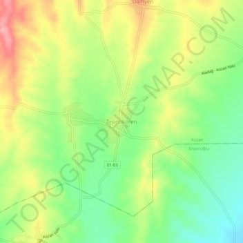
Name: Tepecikören topographic map, elevation, terrain.
Location: Tepecikören, Kozan, Adana, Mediterranean Region, Turkey (37.34332 35.60783 37.38332 35.64783)
Average elevation: 168 m
Minimum elevation: 110 m
Maximum elevation: 239 m
Thank you for supporting this site ❤️
Make a donation
Make a donation
Gear up for your next adventure:
As an Amazon Associate, this site earns from qualifying purchases at no extra cost to you.