Geolocate

Hawley topographic map

Click on the map to display elevation.

About this map

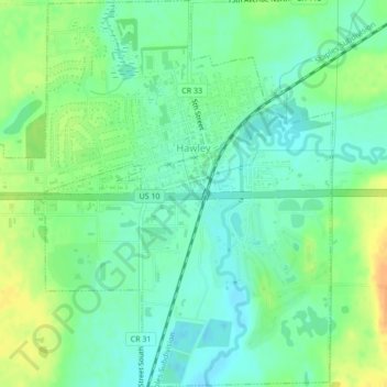
Name: Hawley topographic map, elevation, terrain.

Location: Hawley, Clay County, Minnesota, United States (46.86273 -96.33989 46.89189 -96.30134)

Average elevation: 356 m

Minimum elevation: 343 m

Maximum elevation: 377 m

Other topographic maps

Click on a map to view its topography, its elevation and its terrain.

Ruthruff

United States > Minnesota > Clay County

Average elevation: 279 m

Gear up for your next adventure:

🥾Waterproof Hiking Shoes - Durable shoes for wet and rugged trails
🛶Kayak Dry Bag - Waterproof storage for kayaking adventures
🧥Thermal Fleece Jacket - Versatile insulation for changing mountain temperatures
🧴First Aid Kit - Essential first aid supplies for outdoor emergencies
🔨Vehicle Emergency Tool - Safety tool for remote road trips to trailheads

As an Amazon Associate, this site earns from qualifying purchases at no extra cost to you.