Geolocate

Rigaudon topographic map

Click on the map to display elevation.

About this map
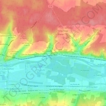
Name: Rigaudon topographic map, elevation, terrain.

Location: Rigaudon, Bourré, Montrichard Val de Cher, Romorantin-Lanthenay, Loir-et-Cher, Centre-Val de Loire, Metropolitan France, 41400, France (47.32642 1.19273 47.36642 1.23273)

Average elevation: 97 m

Minimum elevation: 53 m

Maximum elevation: 140 m

Other topographic maps

Click on a map to view its topography, its elevation and its terrain.

Gear up for your next adventure:

🧥Insulated Jacket - Keep warm in cold outdoor conditions
🥾Trail Hiking Boots - Supportive boots for rough trails
🧥Softshell Jacket - Windproof and breathable jacket for hiking
🧥Fleece Jacket - Warm and lightweight jacket for layering
🩹Moleskin Blister Pads - Direct protection for painful foot pressure points

As an Amazon Associate, this site earns from qualifying purchases at no extra cost to you.