Geolocate

North Windham topographic map

Click on the map to display elevation.

About this map

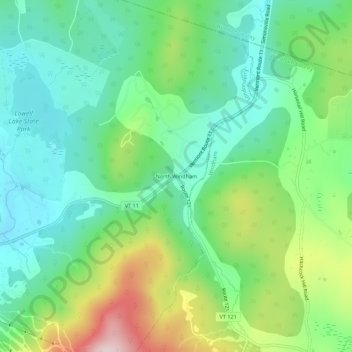
Name: North Windham topographic map, elevation, terrain.

Location: North Windham, Londonderry, Windham County, Vermont, United States (43.19774 -72.76035 43.23774 -72.72035)

Average elevation: 518 m

Minimum elevation: 385 m

Maximum elevation: 813 m

Other topographic maps

Click on a map to view its topography, its elevation and its terrain.

Gear up for your next adventure:

🔋Emergency Crank Radio - Weather alerts and power without needing batteries
🧴Insect Repellent - Protect yourself from bugs during outdoor adventures
🪑Insulated Seat Pad - Protect your seat from cold rocks and wet logs
🧴Bear Spray Holster - Quick-access carry for essential Canadian wilderness safety
🍽️Titanium Camping Spork - Ultralight and indestructible eating utensil

As an Amazon Associate, this site earns from qualifying purchases at no extra cost to you.