Geolocate

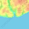
Rospico topographic map

Click on the map to display elevation.

About this map

Name: Rospico topographic map, elevation, terrain.

Location: Rospico, Névez, Quimper, Finistère, Bretagne, France métropolitaine, 29920, France (47.77282 -3.78476 47.81282 -3.74476)

Average elevation: 14 m

Minimum elevation: 0 m

Maximum elevation: 43 m

Other topographic maps

Click on a map to view its topography, its elevation and its terrain.
Anse de Rospico

France > Bretagne > Finistère > Névez > Rospico

Average elevation: 17 m

Gear up for your next adventure:

🧰Emergency Multi-Tool - Compact multi-tool for outdoor survival
🔭Outdoor Binoculars - Lightweight binoculars for birdwatching and hiking
⛺Backpacking Tent - Lightweight tent for long-distance hiking trips
🛶Waterproof Dry Bags - Keep electronics and clothes dry during river crossings
🦟Insect Repellent - Keep mosquitoes and black flies away in wooded areas

As an Amazon Associate, this site earns from qualifying purchases at no extra cost to you.