Geolocate

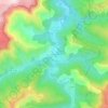
Altier topographic map

Click on the map to display elevation.

About this map

Name: Altier topographic map, elevation, terrain.

Location: Altier, Mende, Lozère, Occitania, Metropolitan France, 48800, France (44.40605 3.80723 44.50836 3.90382)

Average elevation: 1,046 m

Minimum elevation: 556 m

Maximum elevation: 1,680 m

Other topographic maps

Click on a map to view its topography, its elevation and its terrain.
Sauveplane

France > Occitania > Lozère

Average elevation: 463 m

Les Vanels

France > Occitania > Lozère > Vebron

Average elevation: 813 m

Le Coustat

France > Occitania > Lozère > Nasbinals

Average elevation: 1,202 m

Lespartis

France > Occitania > Lozère > Peyre en Aubrac > Aumont-Aubrac

Average elevation: 1,047 m

Gear up for your next adventure:

🧦Outdoor Socks - Durable socks designed for hiking and outdoor sports
🔦LED Headtorch - Bright and durable light for night activities
🧢Hiking Sun Hat - Wide-brimmed protection for exposed mountain ridges
🥾Lightweight Hiking Boots - Boots for comfort and mobility on long hikes
🛶Canoe Life Vest - Safety vest for water sports

As an Amazon Associate, this site earns from qualifying purchases at no extra cost to you.