Geolocate

Kulbing topographic map

Click on the map to display elevation.

About this map

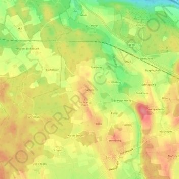
Name: Kulbing topographic map, elevation, terrain.

Location: Kulbing, Laufen, Landkreis Berchtesgadener Land, Bayern, 83410, Deutschland (47.91680 12.86553 47.95680 12.90553)

Average elevation: 436 m

Minimum elevation: 386 m

Maximum elevation: 473 m

Other topographic maps

Click on a map to view its topography, its elevation and its terrain.

Gear up for your next adventure:

🥾Durable Hiking Shoes - Long-lasting shoes for frequent hiking
🧢Sun Protection Cap - Breathable cap to protect from sun exposure
🧥Waterproof Hiking Jacket - Protect yourself from rain and wind while hiking
🚲Handlebar Phone Mount - View topographic-map.com live while cycling
🧊Portable Cooler - Keep food and drinks cold during outdoor adventures

As an Amazon Associate, this site earns from qualifying purchases at no extra cost to you.