Geolocate

Bowmanville topographic map

Click on the map to display elevation.

About this map

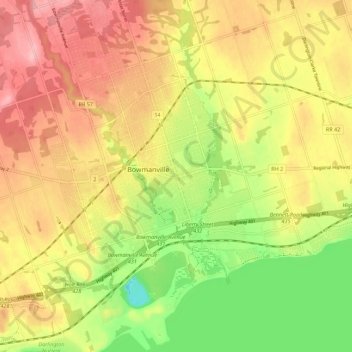
Name: Bowmanville topographic map, elevation, terrain.

Location: Bowmanville, Durham Region, Ontario, L1C, Canada (43.87076 -78.72031 43.95076 -78.64031)

Average elevation: 108 m

Minimum elevation: 26 m

Maximum elevation: 178 m

Ontario trails, hiking, mountain biking, running and outdoor activities

Gear up for your next adventure:

🛌Insulated Sleeping Pad - Critical thermal barrier between you and the cold ground
🧥Fleece Jacket - Warm and lightweight jacket for layering
🧊Insulated Water Bottle - Keeps drinks cold in summer and prevents freezing in winter
🧭GPS Outdoor Watch - Smart watch for navigation and fitness tracking in nature
🔥Emergency Fire Starter - Reliable ignition source for all weather conditions

As an Amazon Associate, this site earns from qualifying purchases at no extra cost to you.