Geolocate

Grady topographic map

Click on the map to display elevation.

About this map

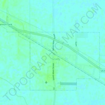
Name: Grady topographic map, elevation, terrain.

Location: Grady, Lincoln County, Arkansas, United States (34.06867 -91.72244 34.09229 -91.68287)

Average elevation: 56 m

Minimum elevation: 53 m

Maximum elevation: 60 m

Gear up for your next adventure:

🥾Mountain Hiking Shoes - Shoes with superior grip for mountainous terrain
🧭GPS Tracker - Track your location in remote areas safely
🥾Hiking Gaiters - Protect legs and shoes from mud, snow, and debris
🥾Trail Hiking Socks - Comfortable socks to prevent blisters and fatigue
🧴Insect Repellent - Protect yourself from bugs during outdoor adventures

As an Amazon Associate, this site earns from qualifying purchases at no extra cost to you.