Geolocate

4th station topographic map

Click on the map to display elevation.

About this map

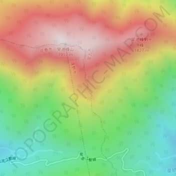
Name: 4th station topographic map, elevation, terrain.

Location: 4th station, Miyako, Iwate Prefecture, Japan (39.54153 141.48353 39.56153 141.50353)

Average elevation: 1,434 m

Minimum elevation: 999 m

Maximum elevation: 1,904 m

Gear up for your next adventure:

🚲Bike Repair Kit - Essential tools for on-trail mechanical issues
🧦Merino Wool Socks - Moisture-wicking comfort for long-distance hiking
🛶Kayak Accessories - Essential gear for safe and fun kayaking adventures
🦶Hiking Shoe Insoles - Added support for high arches and long days on feet
🧥Packable Rain Jacket - Breathable waterproof layer for unpredictable weather

As an Amazon Associate, this site earns from qualifying purchases at no extra cost to you.