
Thank you for supporting this site ❤️
Make a donation
Make a donation
Gear up for your next adventure:
As an Amazon Associate, this site earns from qualifying purchases at no extra cost to you.
Al-'Ula topographic map
Click on the map to display elevation.
Thank you for supporting this site ❤️
Make a donation
Make a donation
Gear up for your next adventure:
As an Amazon Associate, this site earns from qualifying purchases at no extra cost to you.
About this map
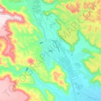
Name: Al-'Ula topographic map, elevation, terrain.
Location: Al-'Ula, Al Madinah Region, 20115, Saudi Arabia (26.44830 37.76271 26.76830 38.08271)
Average elevation: 885 m
Minimum elevation: 571 m
Maximum elevation: 1,499 m
Thank you for supporting this site ❤️
Make a donation
Make a donation
Gear up for your next adventure:
As an Amazon Associate, this site earns from qualifying purchases at no extra cost to you.