
Thank you for supporting this site ❤️
Make a donation
Make a donation
Gear up for your next adventure:
As an Amazon Associate, this site earns from qualifying purchases at no extra cost to you.
Lunata topographic map
Click on the map to display elevation.
Thank you for supporting this site ❤️
Make a donation
Make a donation
Gear up for your next adventure:
As an Amazon Associate, this site earns from qualifying purchases at no extra cost to you.
About this map
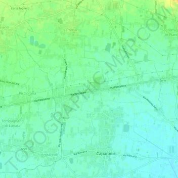
Name: Lunata topographic map, elevation, terrain.
Location: Lunata, Capannori, Lucca, Toscana, 55012, Italia (43.83650 10.54811 43.87650 10.58811)
Average elevation: 19 m
Minimum elevation: 10 m
Maximum elevation: 35 m
Thank you for supporting this site ❤️
Make a donation
Make a donation
Gear up for your next adventure:
As an Amazon Associate, this site earns from qualifying purchases at no extra cost to you.
Other topographic maps
Click on a map to view its topography, its elevation and its terrain.
Lago della Gherardesca
Italia > Toscana > Lucca > Capannori > Colle di Compito
Average elevation: 18 m