Geolocate

Pulilan topographic map

Click on the map to display elevation.

About this map

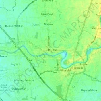
Name: Pulilan topographic map, elevation, terrain.

Location: Pulilan, Central Luzon, 3005, Philippines (14.86180 120.80712 14.94180 120.88712)

Average elevation: 9 m

Minimum elevation: 0 m

Maximum elevation: 19 m

Gear up for your next adventure:

🔭Compact Monocular - One-handed bird watching and trail spotting
🔋Emergency Crank Radio - Weather alerts and power without needing batteries
🚲Bike Repair Kit - Essential tools for on-trail mechanical issues
🥾Waterproof Trail Shoes - Shoes designed to handle wet terrain
🛶Kayak Dry Bag - Waterproof storage for kayaking adventures

As an Amazon Associate, this site earns from qualifying purchases at no extra cost to you.