Geolocate

Sorre topographic map

Click on the map to display elevation.

About this map

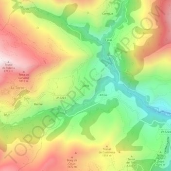
Name: Sorre topographic map, elevation, terrain.

Location: Sorre, Sort, Pallars Sobirá, Lérida, Cataluña, 25567, España (42.43251 1.07835 42.47251 1.11835)

Average elevation: 1,209 m

Minimum elevation: 747 m

Maximum elevation: 1,730 m

Gear up for your next adventure:

🩹Compact First Aid Kit - Pre-packed essentials for common trail injuries
💡LED Headlamp - Hands-free illumination for night hiking and camping
🌬️Windproof Camp Stove - Efficient cooking even on exposed mountain peaks
🧥Fleece Jacket - Warm and lightweight jacket for layering
🏕️Camping Hammock - Integrated protection for sleeping between trees

As an Amazon Associate, this site earns from qualifying purchases at no extra cost to you.