Geolocate

Barrio de Arriba topographic map

Click on the map to display elevation.

About this map

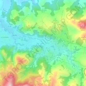
Name: Barrio de Arriba topographic map, elevation, terrain.

Location: Barrio de Arriba, Riotuerto, Cantabria, 39720, España (43.32167 -3.69578 43.36167 -3.65578)

Average elevation: 197 m

Minimum elevation: 57 m

Maximum elevation: 480 m

Gear up for your next adventure:

🧦Hiking Socks - Moisture-wicking and comfortable socks for long hikes
🧥Waterproof Hiking Jacket - Protect yourself from rain and wind while hiking
🧢Outdoor Visor - Breathable visor for sunny hikes
🧦Hiking Liner Socks - Thin base layer to prevent friction and blisters
🥾Trekking Boots - Durable boots for long-distance trekking

As an Amazon Associate, this site earns from qualifying purchases at no extra cost to you.