Geolocate

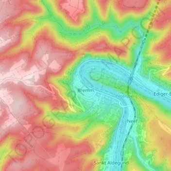
Bremm topographic map

Click on the map to display elevation.

Bremm

The municipality lies at a bow in the river Moselle between Trier and Koblenz, among the sloped vineyards of the Calmont, which with an elevation of 380 m above sea level and a slope of roughly 65° is Europe’s steepest vineyard location. This stretches along the Moselle from Ediger-Eller to Bremm, and is part of the Mosel wine region.

Wikipedia (CC-BY-SA 3.0)

About this map

Name: Bremm topographic map, elevation, terrain.

Location: Bremm, Cochem, Landkreis Cochem-Zell, Rhineland-Palatinate, Germany (50.08509 7.06760 50.11395 7.13606)

Average elevation: 258 m

Minimum elevation: 77 m

Maximum elevation: 422 m

Gear up for your next adventure:

🥾Waterproof Hiking Boots - Boots keeping your feet dry in wet conditions
🧊Insulated Water Bottle - Keeps drinks cold in summer and prevents freezing in winter
🧦Merino Wool Socks - Moisture-wicking comfort for long-distance hiking
Lightweight Backpacking Tent - Compact tent for efficient hiking trips
🥾Trail Hiking Boots - Supportive boots for rough trails

As an Amazon Associate, this site earns from qualifying purchases at no extra cost to you.