Geolocate

Zeihen topographic map

Click on the map to display elevation.

About this map

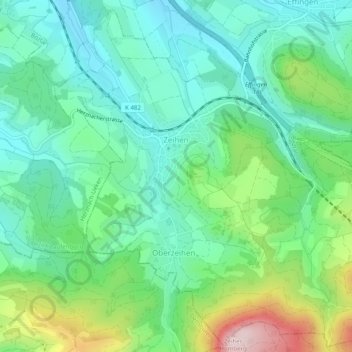
Name: Zeihen topographic map, elevation, terrain.

Location: Zeihen, Bezirk Laufenburg, Aargau, 5079, Switzerland (47.45673 8.06842 47.48935 8.11805)

Average elevation: 513 m

Minimum elevation: 410 m

Maximum elevation: 775 m

Gear up for your next adventure:

Bushcraft Tarp - Versatile emergency shelter or gear protection
Family Camping Tent - Spacious tent suitable for family camping trips
🎒Fully Waterproof Backpack - Total protection for photography gear and electronics
🛏️Sleeping Bag - Warm and compact sleeping bags for outdoor camping
🗺️Topographic Maps - Detailed maps to explore trails, mountains, and wilderness areas

As an Amazon Associate, this site earns from qualifying purchases at no extra cost to you.