Geolocate

Saint Ignace topographic map

Click on the map to display elevation.

About this map

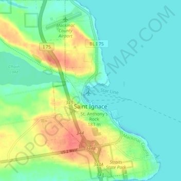
Name: Saint Ignace topographic map, elevation, terrain.

Location: Saint Ignace, Mackinac County, Michigan, United States (45.84806 -84.74219 45.89715 -84.70093)

Average elevation: 189 m

Minimum elevation: 173 m

Maximum elevation: 223 m

Other topographic maps

Click on a map to view its topography, its elevation and its terrain.

Gear up for your next adventure:

🥾Hiking Leggings - Comfortable leggings for outdoor activities
🚲MTB Frame Bag - Carry tools and maps directly on your bicycle frame
🔥Camping Stove - Portable stoves to cook outdoors with ease
🥾Lightweight Hiking Boots - Boots for comfort and mobility on long hikes
🔦LED Flashlight - Powerful and long-lasting flashlight for camping and emergencies

As an Amazon Associate, this site earns from qualifying purchases at no extra cost to you.