
Thank you for supporting this site ❤️
Make a donation
Make a donation
Gear up for your next adventure:
As an Amazon Associate, this site earns from qualifying purchases at no extra cost to you.
Narsdorf topographic map
Click on the map to display elevation.
Thank you for supporting this site ❤️
Make a donation
Make a donation
Gear up for your next adventure:
As an Amazon Associate, this site earns from qualifying purchases at no extra cost to you.
About this map
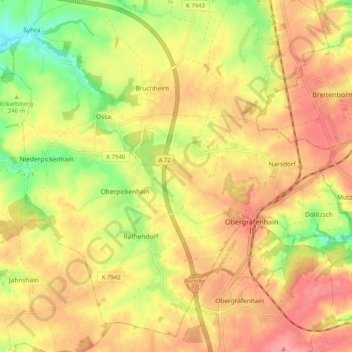
Name: Narsdorf topographic map, elevation, terrain.
Location: Narsdorf, Geithain, Landkreis Leipzig, Sachsen, Deutschland (50.98504 12.64167 51.04367 12.74364)
Average elevation: 256 m
Minimum elevation: 165 m
Maximum elevation: 341 m
Thank you for supporting this site ❤️
Make a donation
Make a donation
Gear up for your next adventure:
As an Amazon Associate, this site earns from qualifying purchases at no extra cost to you.