
Thank you for supporting this site ❤️
Make a donation
Make a donation
Gear up for your next adventure:
As an Amazon Associate, this site earns from qualifying purchases at no extra cost to you.
l'Albiol topographic map
Click on the map to display elevation.
Thank you for supporting this site ❤️
Make a donation
Make a donation
Gear up for your next adventure:
As an Amazon Associate, this site earns from qualifying purchases at no extra cost to you.
About this map
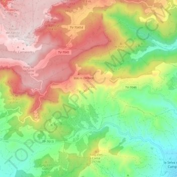
Name: l'Albiol topographic map, elevation, terrain.
Location: l'Albiol, Baix Camp, Tarragona, Catalonië, 43479, Spanje (41.22826 1.05936 41.26626 1.16065)
Average elevation: 611 m
Minimum elevation: 216 m
Maximum elevation: 1,067 m
Thank you for supporting this site ❤️
Make a donation
Make a donation
Gear up for your next adventure:
As an Amazon Associate, this site earns from qualifying purchases at no extra cost to you.
Other topographic maps
Click on a map to view its topography, its elevation and its terrain.