Geolocate

Sora topographic map

Click on the map to display elevation.

About this map

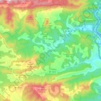
Name: Sora topographic map, elevation, terrain.

Location: Sora, Osona, Barcelona, Catalonia, 08588, Spain (42.07276 2.12592 42.13530 2.21846)

Average elevation: 793 m

Minimum elevation: 572 m

Maximum elevation: 1,139 m

Other topographic maps

Click on a map to view its topography, its elevation and its terrain.

Pla de la Calma

Spain > Catalonia > Osona > el Brull

Average elevation: 1,111 m

Gear up for your next adventure:

🧦Merino Wool Socks - Moisture-wicking comfort for long-distance hiking
🪑Ultralight Camping Stool - Compact seating for rest stops during long hikes
🧥Softshell Jacket - Windproof and breathable jacket for hiking
🌬️Windproof Camp Stove - Efficient cooking even on exposed mountain peaks
🧴Sunscreen SPF - Broad-spectrum sunscreen for outdoor activities

As an Amazon Associate, this site earns from qualifying purchases at no extra cost to you.