Geolocate

Anadur topographic map

Click on the map to display elevation.

About this map

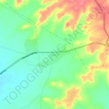
Name: Anadur topographic map, elevation, terrain.

Location: Anadur, Tuljapur, Osmanabad, Maharashtra, India (17.79638 76.22161 17.83638 76.26161)

Average elevation: 556 m

Minimum elevation: 524 m

Maximum elevation: 602 m

Gear up for your next adventure:

🥤Collapsible Travel Cup - Saves space and weight in your mess kit
🔭Outdoor Binoculars - Lightweight binoculars for birdwatching and hiking
🐕Hiking Dog Pack - Let your canine companion carry their own water and food
🥾Mountain Trail Shoes - High-traction shoes for mountain trails
🥾Trail Hiking Shoes - Durable shoes designed for rugged trails

As an Amazon Associate, this site earns from qualifying purchases at no extra cost to you.