Geolocate

Guiyang topographic map

Click on the map to display elevation.

About this map

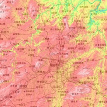
Name: Guiyang topographic map, elevation, terrain.

Location: Guiyang, Guizhou, China (26.18678 106.11897 27.35999 107.27469)

Average elevation: 1,219 m

Minimum elevation: 569 m

Maximum elevation: 1,811 m

Other topographic maps

Click on a map to view its topography, its elevation and its terrain.

Keji

China > Guizhou > Anlong > Sayu

Average elevation: 1,437 m

Napan

China > Guizhou > Wangmo

Average elevation: 1,078 m

Gear up for your next adventure:

🪑Ultralight Camping Stool - Compact seating for rest stops during long hikes
🕶️Polarized Sunglasses - Reduces glare from snow and water at high elevations
🔪Outdoor Multitool - Versatile tool for repairs and food prep in the wild
🔥Emergency Fire Starter - Reliable ignition source for all weather conditions
🥾Hiking Gaiters - Protect legs and shoes from mud, snow, and debris

As an Amazon Associate, this site earns from qualifying purchases at no extra cost to you.