
Thank you for supporting this site ❤️
Make a donation
Make a donation
Gear up for your next adventure:
As an Amazon Associate, this site earns from qualifying purchases at no extra cost to you.
Rumipamba topographic map
Click on the map to display elevation.
Thank you for supporting this site ❤️
Make a donation
Make a donation
Gear up for your next adventure:
As an Amazon Associate, this site earns from qualifying purchases at no extra cost to you.
About this map
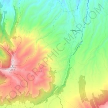
Name: Rumipamba topographic map, elevation, terrain.
Location: Rumipamba, Sangolqui, Pichincha, Ecuador (-0.50700 -78.48464 -0.40126 -78.40554)
Average elevation: 3,291 m
Minimum elevation: 2,767 m
Maximum elevation: 4,185 m
Thank you for supporting this site ❤️
Make a donation
Make a donation
Gear up for your next adventure:
As an Amazon Associate, this site earns from qualifying purchases at no extra cost to you.