Geolocate

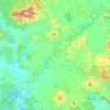
Tītoki topographic map

Click on the map to display elevation.

About this map

Name: Tītoki topographic map, elevation, terrain.

Location: Tītoki, Whangārei District, Northland, New Zealand (-35.75412 174.03713 -35.71412 174.07713)

Average elevation: 43 m

Minimum elevation: 6 m

Maximum elevation: 113 m

Other topographic maps

Click on a map to view its topography, its elevation and its terrain.

Gear up for your next adventure:

🛏️Sleeping Bag - Warm and compact sleeping bags for outdoor camping
🛶Canoe Life Vest - Safety vest for water sports
🧥Waterproof Hiking Jacket - Protect yourself from rain and wind while hiking
🧢Hiking Hat - Sun-protective and breathable hats for long treks
🧦Hiking Liner Socks - Thin base layer to prevent friction and blisters

As an Amazon Associate, this site earns from qualifying purchases at no extra cost to you.