
Thank you for supporting this site ❤️
Make a donation
Make a donation
Gear up for your next adventure:
As an Amazon Associate, this site earns from qualifying purchases at no extra cost to you.
Dalvík topographic map
Click on the map to display elevation.
Thank you for supporting this site ❤️
Make a donation
Make a donation
Gear up for your next adventure:
As an Amazon Associate, this site earns from qualifying purchases at no extra cost to you.
About this map
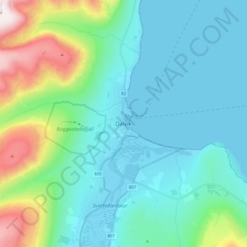
Name: Dalvík topographic map, elevation, terrain.
Location: Dalvík, Dalvíkurbyggð, Northeastern Region, 620, Iceland (65.93109 -18.57044 66.01109 -18.49044)
Average elevation: 182 m
Minimum elevation: -7 m
Maximum elevation: 928 m
Thank you for supporting this site ❤️
Make a donation
Make a donation
Gear up for your next adventure:
As an Amazon Associate, this site earns from qualifying purchases at no extra cost to you.