Geolocate

West Concord topographic map

Click on the map to display elevation.

About this map
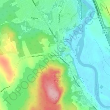
Name: West Concord topographic map, elevation, terrain.

Location: West Concord, Concord, Merrimack County, New Hampshire, 03301, United States (43.22369 -71.59285 43.26369 -71.55285)

Average elevation: 118 m

Minimum elevation: 66 m

Maximum elevation: 234 m

Other topographic maps

Click on a map to view its topography, its elevation and its terrain.
Gear up for your next adventure:

🧢Outdoor Cap - Protective cap for sun and rain during hikes
🧦Hiking Liner Socks - Thin base layer to prevent friction and blisters
⛺Bushcraft Tarp - Versatile emergency shelter or gear protection
🧴Sunscreen SPF - Broad-spectrum sunscreen for outdoor activities
🧦Merino Wool Socks - Moisture-wicking comfort for long-distance hiking

As an Amazon Associate, this site earns from qualifying purchases at no extra cost to you.