Geolocate

Rajwar topographic map

Click on the map to display elevation.

About this map

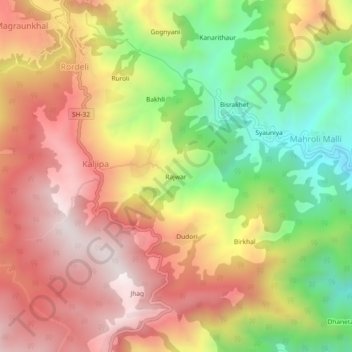
Name: Rajwar topographic map, elevation, terrain.

Location: Rajwar, Kaljipa, Syalde, Almora, Uttarakhand, 263665, India (29.79541 79.12917 29.83541 79.16917)

Average elevation: 1,574 m

Minimum elevation: 1,122 m

Maximum elevation: 1,951 m

Gear up for your next adventure:

🧭GPS Handheld Device - Reliable GPS navigation for outdoor adventures
🧥Insulated Jacket - Keep warm in cold outdoor conditions
🦶Anti-Blister Balm - Prevents friction and hotspots during long ascents
🧢Hiking Hat - Sun-protective and breathable hats for long treks
🥫Freeze-Dried Meals - Lightweight, high-calorie nutrition for multi-day treks

As an Amazon Associate, this site earns from qualifying purchases at no extra cost to you.