
Dhayet Bendhahoua ⴹⴰⵢⴻⵜ ⴱⴻⵏ ⴹⴻⵃⵡⴰⵏ topographic map
Interactive map
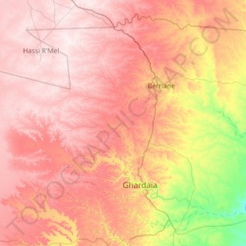
Click on the map to display elevation.
About this map
Name: Dhayet Bendhahoua ⴹⴰⵢⴻⵜ ⴱⴻⵏ ⴹⴻⵃⵡⴰⵏ topographic map, elevation, terrain.
Average elevation: 607 m
Minimum elevation: 362 m
Maximum elevation: 804 m