
Thank you for supporting this site ❤️
Make a donation
Make a donation
Gear up for your next adventure:
As an Amazon Associate, this site earns from qualifying purchases at no extra cost to you.
meas topographic map
Click on the map to display elevation.
Thank you for supporting this site ❤️
Make a donation
Make a donation
Gear up for your next adventure:
As an Amazon Associate, this site earns from qualifying purchases at no extra cost to you.
About this map
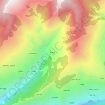
Name: meas topographic map, elevation, terrain.
Location: meas, Chaurah, Chamba, Himachal Pradesh, India (32.89684 76.19401 32.93684 76.23401)
Average elevation: 2,580 m
Minimum elevation: 1,728 m
Maximum elevation: 3,441 m
Thank you for supporting this site ❤️
Make a donation
Make a donation
Gear up for your next adventure:
As an Amazon Associate, this site earns from qualifying purchases at no extra cost to you.