
Thank you for supporting this site ❤️
Make a donation
Make a donation
Gear up for your next adventure:
As an Amazon Associate, this site earns from qualifying purchases at no extra cost to you.
خنداب topographic map
Click on the map to display elevation.
Thank you for supporting this site ❤️
Make a donation
Make a donation
Gear up for your next adventure:
As an Amazon Associate, this site earns from qualifying purchases at no extra cost to you.
About this map
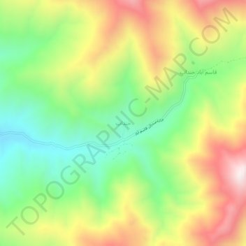
Name: خنداب topographic map, elevation, terrain.
Location: خنداب, بخش مرکزی, Asadabad County, Hamadan Province, Iran (34.74300 48.18616 34.78300 48.22616)
Average elevation: 2,091 m
Minimum elevation: 1,763 m
Maximum elevation: 2,517 m
Thank you for supporting this site ❤️
Make a donation
Make a donation
Gear up for your next adventure:
As an Amazon Associate, this site earns from qualifying purchases at no extra cost to you.