
Thank you for supporting this site ❤️
Make a donation
Make a donation
Gear up for your next adventure:
As an Amazon Associate, this site earns from qualifying purchases at no extra cost to you.
Bunagu topographic map
Click on the map to display elevation.
Thank you for supporting this site ❤️
Make a donation
Make a donation
Gear up for your next adventure:
As an Amazon Associate, this site earns from qualifying purchases at no extra cost to you.
About this map
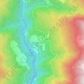
Name: Bunagu topographic map, elevation, terrain.
Location: Bunagu, Bunakha, Chaapchha Gewog, Chukha, Bhutan (27.12495 89.52429 27.16495 89.56429)
Average elevation: 2,349 m
Minimum elevation: 1,846 m
Maximum elevation: 3,066 m
Thank you for supporting this site ❤️
Make a donation
Make a donation
Gear up for your next adventure:
As an Amazon Associate, this site earns from qualifying purchases at no extra cost to you.