Geolocate

Ucluelet topographic map

Click on the map to display elevation.

About this map

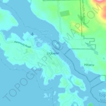
Name: Ucluelet topographic map, elevation, terrain.

Location: Ucluelet, British Columbia, V0R 3A0, Canada (48.92268 -125.56605 48.96268 -125.52605)

Average elevation: 19 m

Minimum elevation: -2 m

Maximum elevation: 191 m

British Columbia trails, hiking, mountain biking, running and outdoor activities

Gear up for your next adventure:

🦶Anti-Blister Balm - Prevents friction and hotspots during long ascents
🧴Insect Repellent - Protect yourself from bugs during outdoor adventures
🥾Trail Hiking Socks - Comfortable socks to prevent blisters and fatigue
Lightweight Backpacking Tent - Compact tent for efficient hiking trips
🌡️Emergency Mylar Blankets - Compact thermal protection for unexpected nights outdoors

As an Amazon Associate, this site earns from qualifying purchases at no extra cost to you.