Geolocate

Petalaca topographic map

Click on the map to display elevation.

About this map

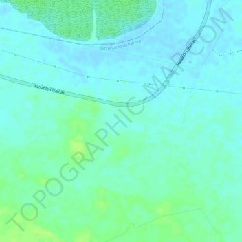
Name: Petalaca topographic map, elevation, terrain.

Location: Petalaca, Palmito, Morrosquillo, Sucre, Colombia (9.37181 -75.63537 9.39181 -75.61537)

Average elevation: 6 m

Minimum elevation: -1 m

Maximum elevation: 14 m

Gear up for your next adventure:

💧Collapsible Water Bottle - Space-saving water bottle for outdoor activities
🛰️Satellite Messenger - Emergency communication for areas with no cell service
🛶Canoe Life Vest - Safety vest for water sports
🧣Evaporative Cooling Towel - Beat the heat during intense summer climbs
🧴Outdoor Sunscreen - High SPF protection for high-altitude UV exposure

As an Amazon Associate, this site earns from qualifying purchases at no extra cost to you.