Geolocate

Gravedona topographic map

Click on the map to display elevation.

About this map

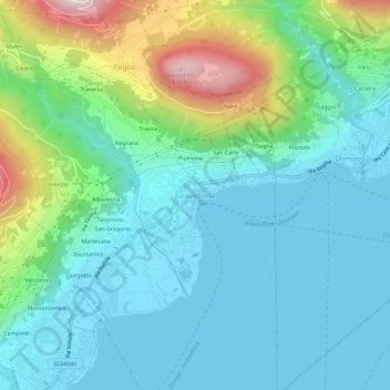
Name: Gravedona topographic map, elevation, terrain.

Location: Gravedona, Gravedona ed Uniti, Como, Lombardy, 22015, Italy (46.12719 9.28526 46.16719 9.32526)

Average elevation: 361 m

Minimum elevation: 197 m

Maximum elevation: 920 m

Gear up for your next adventure:

🥾Trail Hiking Boots - Supportive boots for rough trails
🔋Emergency Crank Radio - Weather alerts and power without needing batteries
🧴Waterproofing Spray - Restore the DWR coating on jackets and tents
🔋Solar Power Bank - Keep your GPS and devices charged during long outdoor trips
🍽️Titanium Camping Spork - Ultralight and indestructible eating utensil

As an Amazon Associate, this site earns from qualifying purchases at no extra cost to you.