Geolocate

Bukit Tinggi topographic map

Click on the map to display elevation.

About this map

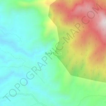
Name: Bukit Tinggi topographic map, elevation, terrain.

Location: Bukit Tinggi, Dairi, North Sumatra, Sumatra, Indonesia (2.84965 98.29802 2.88965 98.33802)

Average elevation: 914 m

Minimum elevation: 608 m

Maximum elevation: 1,507 m

Gear up for your next adventure:

🥾Hiking Gaiters - Protect legs and shoes from mud, snow, and debris
🥽Outdoor Goggles - Protective eyewear for outdoor activities
🧦Merino Wool Socks - Moisture-wicking comfort for long-distance hiking
🕶️Polarized Sunglasses - Protect your eyes with durable polarized lenses
🛌Insulated Sleeping Pad - Critical thermal barrier between you and the cold ground

As an Amazon Associate, this site earns from qualifying purchases at no extra cost to you.