Geolocate

Bad Essen topographic map

Click on the map to display elevation.

About this map

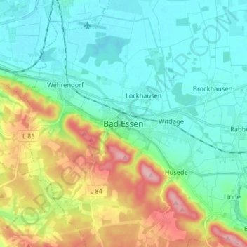
Name: Bad Essen topographic map, elevation, terrain.

Location: Bad Essen, Landkreis Osnabrück, Lower Saxony, 49152, Germany (52.27958 8.30406 52.35958 8.38406)

Average elevation: 85 m

Minimum elevation: 42 m

Maximum elevation: 194 m

Gear up for your next adventure:

🚲Heavy Duty Bike Lock - Secure your bike at the trailhead or during stops
🥤Collapsible Travel Cup - Saves space and weight in your mess kit
🧢Sun Hat - Wide-brim hat for sun protection
🥾Hiking Boots - Sturdy boots providing ankle support and traction on rugged trails
🌬️Windproof Camp Stove - Efficient cooking even on exposed mountain peaks

As an Amazon Associate, this site earns from qualifying purchases at no extra cost to you.