Geolocate

Laredo Texas topographic map

Click on the map to display elevation.

About this map

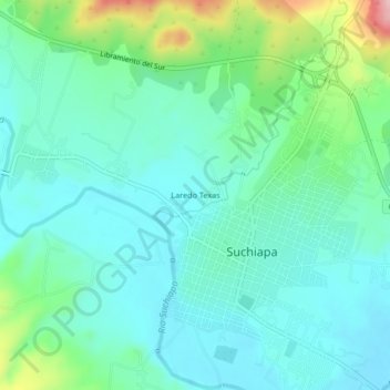
Name: Laredo Texas topographic map, elevation, terrain.

Location: Laredo Texas, Suchiapa, Chiapas, 29150, Mexico (16.61106 -93.12450 16.65106 -93.08450)

Average elevation: 467 m

Minimum elevation: 422 m

Maximum elevation: 619 m

Gear up for your next adventure:

🥾Mountain Trail Shoes - High-traction shoes for mountain trails
Camping Coffee Maker - Brew fresh coffee anywhere on the topographic map
Bushcraft Tarp - Versatile emergency shelter or gear protection
🛌Down Sleeping Bag - Superior warmth-to-weight ratio for cold nights
👟Leg Gaiters - Keep debris, mud, and snow out of your boots

As an Amazon Associate, this site earns from qualifying purchases at no extra cost to you.