
Castillo Pedroso topographic map
Click on the map to display elevation.
Castillo Pedroso
Castillo Pedroso es una localidad del municipio de Corvera de Toranzo (Cantabria, España). En el año 2024 contaba con una población de 119 habitantes (INE). La localidad se encuentra a 463 metros de altitud sobre el nivel del mar, y a 5 kilómetros de la capital municipal, San Vicente de Toranzo.
About this map
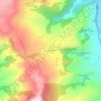
Name: Castillo Pedroso topographic map, elevation, terrain.
Location: Castillo Pedroso, Corvera de Toranzo, Cantabria, 39699, España (43.19582 -3.99099 43.23582 -3.95099)
Average elevation: 426 m
Minimum elevation: 118 m
Maximum elevation: 754 m