Geolocate

Perchting topographic map

Click on the map to display elevation.

Perchting

Eingebettet in die Moränenlandschaft zwischen Ammersee und Starnberger See liegt Perchting in der Mitte des Fünfseenlandes. Im Süden grenzen die Fluren des Dorfes an den Maisinger See. Der Blick von den Hügeln, die den Ort flankieren, reicht über die Höhenrücken im Ammer-Loisach-Hügelland bis zu den Bergen des Wettersteingebirges.

Wikipedia (CC-BY-SA 3.0)

About this map

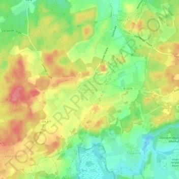
Name: Perchting topographic map, elevation, terrain.

Location: Perchting, Starnberg, Wörthsee, Landkreis Starnberg, Bayern, 82319, Deutschland (47.97985 11.25447 48.01985 11.29447)

Average elevation: 668 m

Minimum elevation: 627 m

Maximum elevation: 711 m

Gear up for your next adventure:

🛰️Satellite Messenger - Emergency communication for areas with no cell service
🌡️Emergency Mylar Blankets - Compact thermal protection for unexpected nights outdoors
🧊Insulated Water Bottle - Keeps drinks cold in summer and prevents freezing in winter
🧦Hiking Socks - Moisture-wicking and comfortable socks for long hikes
🦶Anti-Blister Balm - Prevents friction and hotspots during long ascents

As an Amazon Associate, this site earns from qualifying purchases at no extra cost to you.