
Bignaou topographic map
Interactive map
Click on the map to display elevation.
About this map
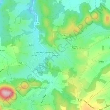
Name: Bignaou topographic map, elevation, terrain.
Average elevation: 417 m
Minimum elevation: 342 m
Maximum elevation: 575 m
Other topographic maps
Click on a map to view its topography, its elevation and its terrain.
Graou
France > Occitanie > Haute-Garonne > Ganties
Graou, Ganties, Saint-Gaudens, Haute-Garonne, Occitanie, France métropolitaine, 31160, France
Average elevation: 411 m