
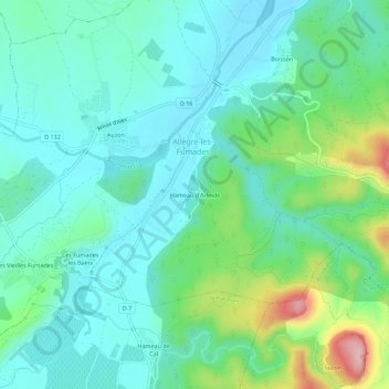
Hameau d'Arlinde topographic map
Interactive map
Click on the map to display elevation.
About this map
Name: Hameau d'Arlinde topographic map, elevation, terrain.
Average elevation: 173 m
Minimum elevation: 118 m
Maximum elevation: 351 m
Other topographic maps
Click on a map to view its topography, its elevation and its terrain.
Boisson
France > Occitanie > Gard > Allègre-les-Fumades
Boisson, Allègre-les-Fumades, Alès, Gard, Occitanie, France métropolitaine, 30500, France
Average elevation: 170 m