
Thank you for supporting this site ❤️
Make a donation
Make a donation
Gear up for your next adventure:
As an Amazon Associate, this site earns from qualifying purchases at no extra cost to you.
Caprile topographic map
Click on the map to display elevation.
Thank you for supporting this site ❤️
Make a donation
Make a donation
Gear up for your next adventure:
As an Amazon Associate, this site earns from qualifying purchases at no extra cost to you.
About this map
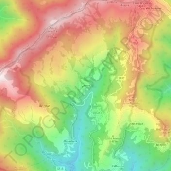
Name: Caprile topographic map, elevation, terrain.
Location: Caprile, Propata, Genova, Liguria, 16027, Italia (44.55189 9.16260 44.59189 9.20260)
Average elevation: 1,187 m
Minimum elevation: 786 m
Maximum elevation: 1,565 m
Thank you for supporting this site ❤️
Make a donation
Make a donation
Gear up for your next adventure:
As an Amazon Associate, this site earns from qualifying purchases at no extra cost to you.