
Blaschette topographic map
Interactive map
Click on the map to display elevation.
About this map
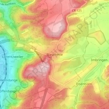
Name: Blaschette topographic map, elevation, terrain.
Location: Blaschette, Canton Mersch, 7391, Luxembourg (49.68197 6.14778 49.72197 6.18778)
Average elevation: 339 m
Minimum elevation: 221 m
Maximum elevation: 438 m