
Septfontaines topographic map
Interactive map
Click on the map to display elevation.
About this map
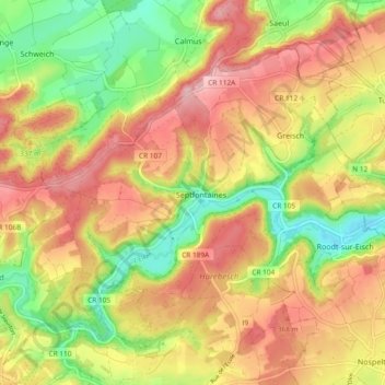
Name: Septfontaines topographic map, elevation, terrain.
Location: Septfontaines, Habscht, Canton Capellen, Luxembourg (49.67852 5.92933 49.72373 6.02282)
Average elevation: 324 m
Minimum elevation: 243 m
Maximum elevation: 395 m
Other topographic maps
Click on a map to view its topography, its elevation and its terrain.